
FAQ
What is a PDA development scheme?
The development scheme is the overarching planning document that controls land use, infrastructure planning and development in the priority development area (PDA).
The development scheme ensures development is well planned and provides certainty about the type and form of development that can occur in the PDA.
How long will the community have to comment on the proposed development scheme?
The community will have 30 business days from Monday 25 February to
Friday 5 April to lodge a formal submission.
How do I make a submission?
Submissions may be made to the MEDQ by:
Online: www.qld.gov.au/oxley
Email: edq@dsdmip.qld.gov.au
Post: Economic Development Queensland
GPO Box 2202 Brisbane QLD 4001
Will the community be able to comment on all elements for the proposed development scheme?
Yes, all interested parties, including the community, residents and business operators, are invited to view the proposed development scheme and provide feedback on all elements of the proposed scheme.
Will submissions be considered in finalising the development scheme?
All submissions received during the submission period will be considered by the MEDQ.
A submissions report will be prepared summarising the submissions received and the merits of those submissions. In some cases amendments may be made to the proposed development scheme as a consequence of issues raised in submissions.
I noticed a blue, foam like substance on part of the site. What is it and should I be concerned about it?
The substance is non-toxic chemical suppressant commonly referred to as hydro—seeding and poses no risk to people. It is frequently used in building and civil projects to stabilise soil, prevent erosion and suppress dust.
When the sunnier weather returns the substance will initially bake and firm into a blue green film over the site. Once active construction begins the foam will harmlessly break down and water shall be primarily used for dust suppression.What does the declaration of a Priority Development Area mean?
A Priority Development Area (PDA) is a parcel of land identified for specific development, that facilitates economic development and development for community purposes.
Once a PDA is declared under the Economic Development Act 2012, a development scheme for the PDA must be prepared. The development scheme is the overarching planning document for the site.
Economic Development Queensland (EDQ) has 12 months to prepare the development scheme. Until the development scheme is finalised, development within the PDA will be regulated under the Interim Land Use Plan.
What is proposed for the site?
EDQ has undertaken investigations and community engagement on the future of this site since 2016 when it was identified for potential renewal as part of the Advancing our cities and regions strategy.
In response to the community’s views it is proposed that the redevelopment will see some 80 percent of the site dedicated to open space, recreation, environmental protection, roads and community use.
Any redevelopment of the site will include detached housing, similar to what is currently in the surrounding area, multi-level housing for seniors and the relocation of the C&K Childcare Centre out of the flood zone.
Where on the site will the child care be relocated?
It is proposed the child centre will co-locate with a new retirement/ageing
in place facility and community centre, creating opportunities for connections
between them, including the shared use of a nearby community garden.
What will be done with the existing child care building?
It is proposed that, if possible, the existing child care building will
be retained as a “refurbished” club house for the adjoining open space.
What measure will be taken to fix the land slip issues?
The land slip (previously referred to as “sink holes”) have been caused by a combination of uncontrolled fill on the site and poor subsurface drainage. This has also affected properties adjoining the site, and in the surrounding suburb.
The plan to stabilise the slopes includes the introduction of drainage solutions (swales) and detention basins, preserving quality trees, de-weeding, augmenting existing vegetation with suitable species and employing Water Sensitive Urban Design (WSUD).
How will the increased traffic on Seventeen Mile Rocks Road, an already congested road, be managed?
A traffic analysis has been carried out and report recommendations will
be incorporated into any proposed works, including road and roundabout upgrades
near the access point from Seventeen Mile Rocks Road.
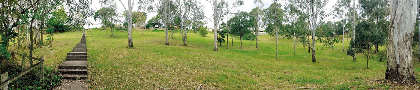
What will happen to the vegetation on the site?
Significant vegetation makes up a large part of the site. A key outcome
for this redevelopment project is to preserve endangered vegetation and, where ever
possible elsewhere, retain existing significant vegetation and enhance the
vegetation with suitable species to stabilise the soil on the slopes in the
public open space areas and road verges.
How will this project help the economy and support jobs?
It is expected during construction approximately 340 jobs will be
supported over the next 4 years and in the longer term provide an annual
economic boost of $46.2 million.
May 2018
Why can't we just have a school?
The college was declared surplus to requirements in 2001 and Education Queensland has determined the existing network of schools will be able to accommodate future needs and re-opening the school is not a viable option for the site.
Why has it taken the state government so long to come back to the community about the future use of Oxley?
What will be presented to the community at the information sessions?
What will it mean if the site is declared a PDA?
Oxley is a prime example of the Queensland Government’s Advancing our cities and regions strategy, generating economic growth by unlocking the potential of underutilised government-owned land.
Declaring a PDA means EDQ would become the planning and development assessment authority for the site as well as the master developer, enabling an accelerated delivery of innovative and best practice urban design and new community facilities on the site.
Due to the number of constraints affecting the site, including flooding, matters of state environmental significance, vegetation and sinkhole and landslip areas, renewal of the site by private sector developers would be considered unlikely. The declaration of a PDA would enable remediation works to be undertaken by EDQ as quickly as possible within the landslip area to ensure community safety.
The declaration of a PDA for Oxley has the potential to:
· create jobs through construction and completed development
· unlock government land to help catalyse broader local investment
· deliver development with community benefit (community centre, open space, retention of bushland and relocation of C&K Childcare out of the flood area)
· streamline plan making and development assessment including addressing key state interests up-front in the plan making process.
What has been included in the proposed concept?
EDQ has investigated several scenarios to find the right balance of development for economic and community benefit.
Currently the preferred scenario would include:
· excluding areas of Matters of State Environmental Significance (MSES), landslip and flood in the development zone
· a new aged care/retirement facility, a community centre, community garden and open space
· the relocation of the C&K Childcare out of the flood area
· provisions to manage traffic and car parking impacts
· an average residential lot size of 800 square metres, that will compliment and integrate well with the surrounding suburbs.
What will happen to the existing vegetation on the site?
Across the 19.74 ha site there is a 2 ha parcel of land slip which will be treated but not developed. A further 2 ha area will receive significant vegetation planting treatment to landslip affected areas.
What community engagement has been undertaken previously?
Community engagement activities began in 2016 and included two newsletters distributed to approximately 9500 households about community engagement opportunities and outcomes, an online survey that attracted 202 responses and two community information sessions attended by approximately 200 people.
EDQ also established a community panel, representing the greater community that coordinated a community-led engagement process.
EDQ also met with a number of community organisations who had specifically nominated an interest in being part of any reinvigoration of the site and to identify what facilities they may require in any future development of the site.
Discussions with Indigenous Elders about expressed interest in recreational and community facilities on the site were also held.
Feedback from the initial engagement campaign assisted with the development of the proposed concept and design principles and reflects the community’s needs for:
· retention of significant bushland
· provision of open space
· flooding and landslip to be mitigated
· management of traffic and car parking
· a community hub, including a community centre and retaining the C&K Childcare on site (preferably out of the flood area)
· a mix of low-rise residential (including retirement/aged care).
What is the proposed maximum building height for the site?
Development will be of an appropriate scale. The maximum building height for residential dwellings will be 3 storeys where integrated with the natural slope of the site. The retirement facility may be up to a maximum of 6 storeys.
When are construction works expected to begin?
Some early works have been completed to sure up the site, specifically addressing sink holes and landslip. Once the site is declared a PDA, demolition of the former college buildings would likely begin towards the end of the year. These works would ensure public safety and the safety of existing adjoining land owners backing onto the site along Seventeen Mile Rocks Road and Blackheath Road.
December 2018
When are works going to begin?
The first signs of on-site activity are expected to begin the week commencing 10 December 2018. These works will include the erection of perimeter fencing, installation of a temporary site office and safety signage, and disconnection of services.
The heavy demolition of buildings and major structures using excavators or other machinery will not commence until structures are free from hazardous substances.
What works can local expect to see happening on the site?
The works will include demolition and removal from the site of all
existing school buildings, including asbestos, concrete slabs, footings, piers,
any underground structures and services.
What procedures will be in place to keep the community safe during the demolition works?
All works including the demolition of structures and removal of asbestos will be carried out in accordance with the relevant Queensland Work Health and Safety Acts, Regulations and Guidelines and relevant codes of practice that govern the management and disposal of such materials. For example, asbestos and all other hazardous materials removed from buildings will be hosed down and transported in trucks with sealed tarps or skip bins.
Signage indicating the area is private property, a demolition site and that asbestos removal works are in progress will also be installed prior to works commencing.
When will the demolition works be completed?
The bulk of building demolition works are expected to be completed by the end of January 2019.
What access point to the site will the contractor be using?
Access to and from the site will be from Seventeen Mile Rocks Road. There will be project related traffic or parking on Blackheath Road or Cliveden Avenue.
What are the working hours?
Works on site will be undertaken between 6.30 am and 6.30 pm Monday to Saturday. There will be no truck movements after 4.00 pm on Fridays and Saturdays.
Generally there will be no more than 30 truck movements a day at the height of the load out.What mechanisms will be put in place to address dust and air quality, storm water, noise, odours and traffic etc?
The contractor is required to prepare a Project Management Plan (PMP)
which includes all aspects of the demolition phase, potential remediation phase
and finishing phase of the works. The PMP addresses these items as well as all
health and safety plans including an asbestos management plan.
What measures will be in place for the safe cartage of any contaminated materials including asbestos?
The contractor must prepare a Safe Work Methods Statement (SWMS) for all works on the site including the handling of hazardous and contaminated materials.
Any identified asbestos materials will be treated and transported as per appropriate Acts, Regulations and Guidelines and relevant codes of practice. For example, it is a mandatory for all materials to be hosed down and transported in trucks with sealed tarps or skip bins where the asbestos is double wrapped in plastic and sealed.
How will the works impact neighbouring residents and the C&K?
Every effort will be made to minimise the impacts on traffic flow and surrounding residents as a result of the demolition activities.
With respect to the C&K child care centre, the demolition work zone will be contained to as small as possible an area to minimise the impact to their premises and daily operations.